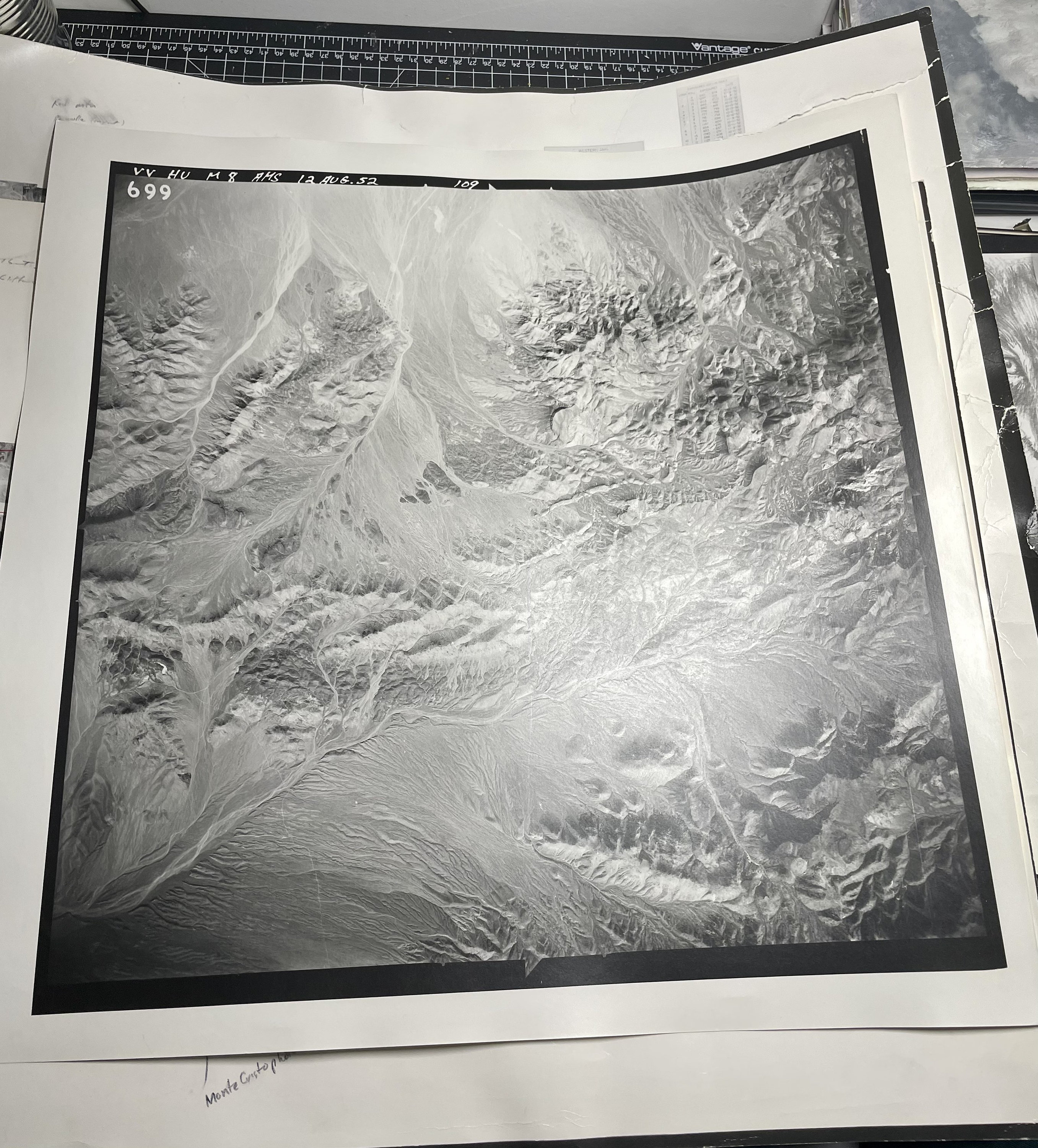
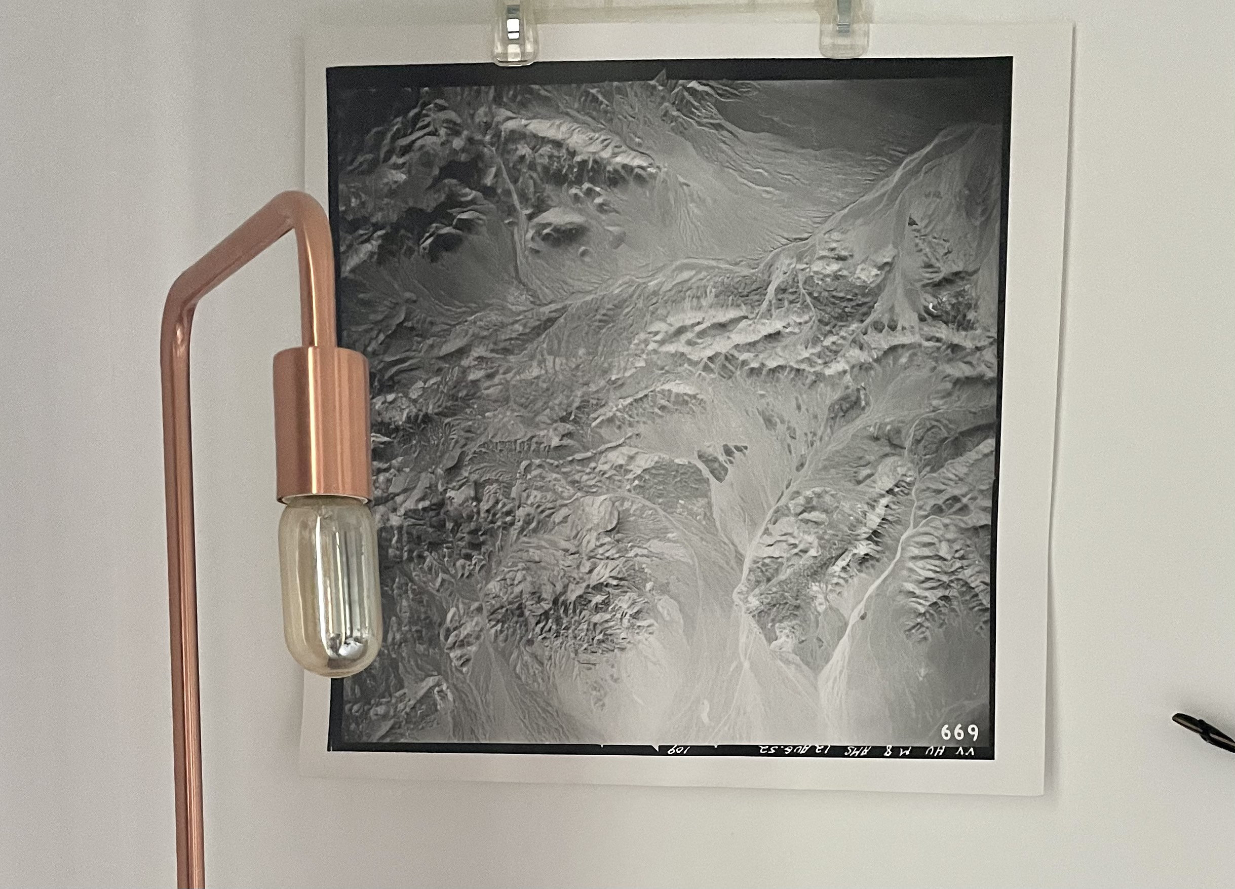
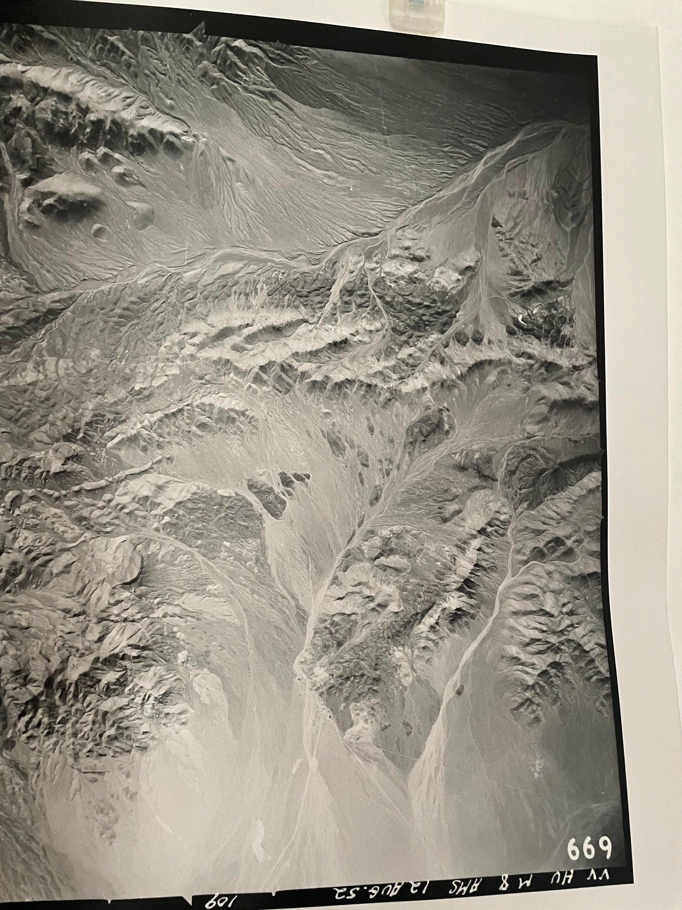
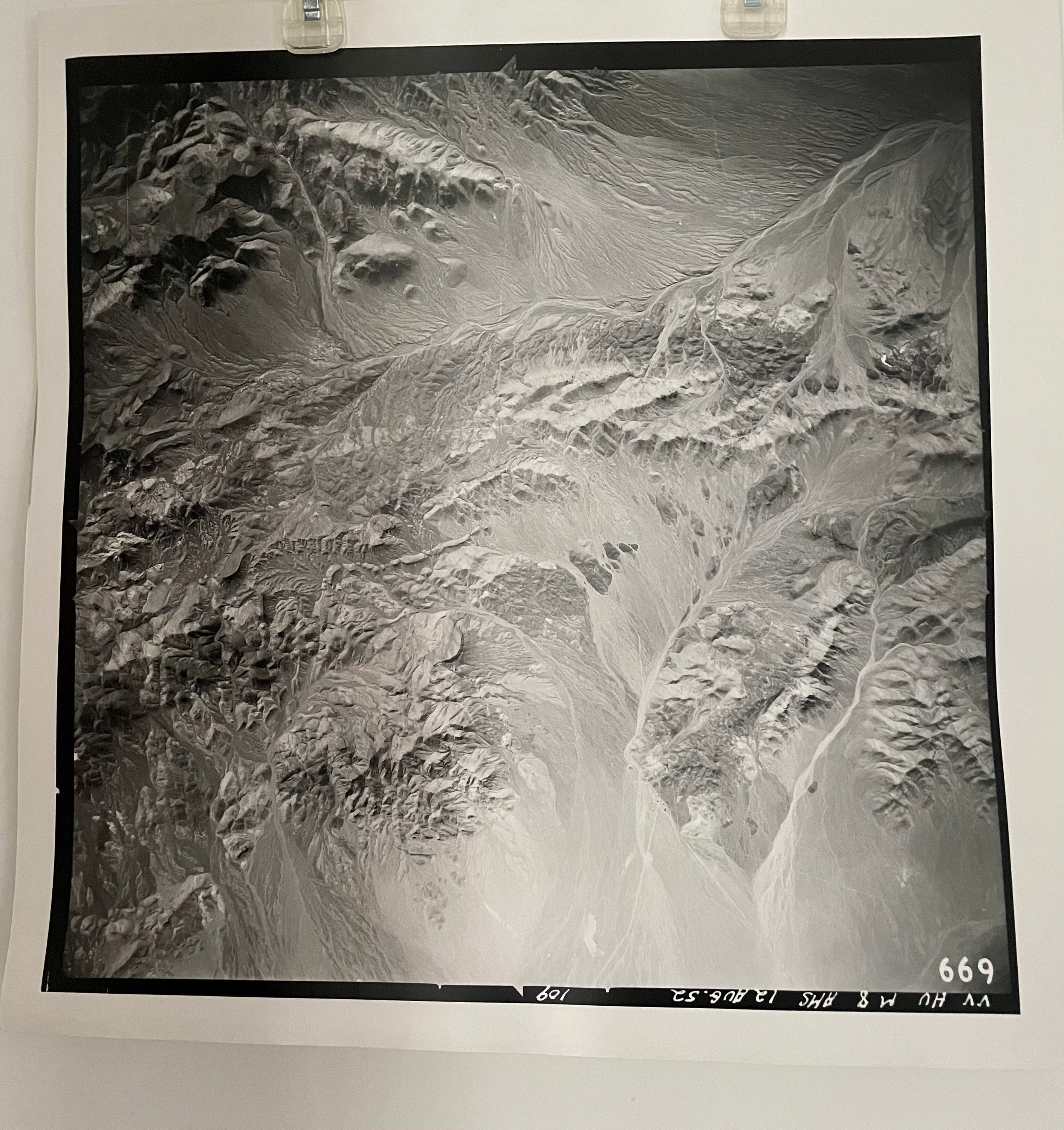
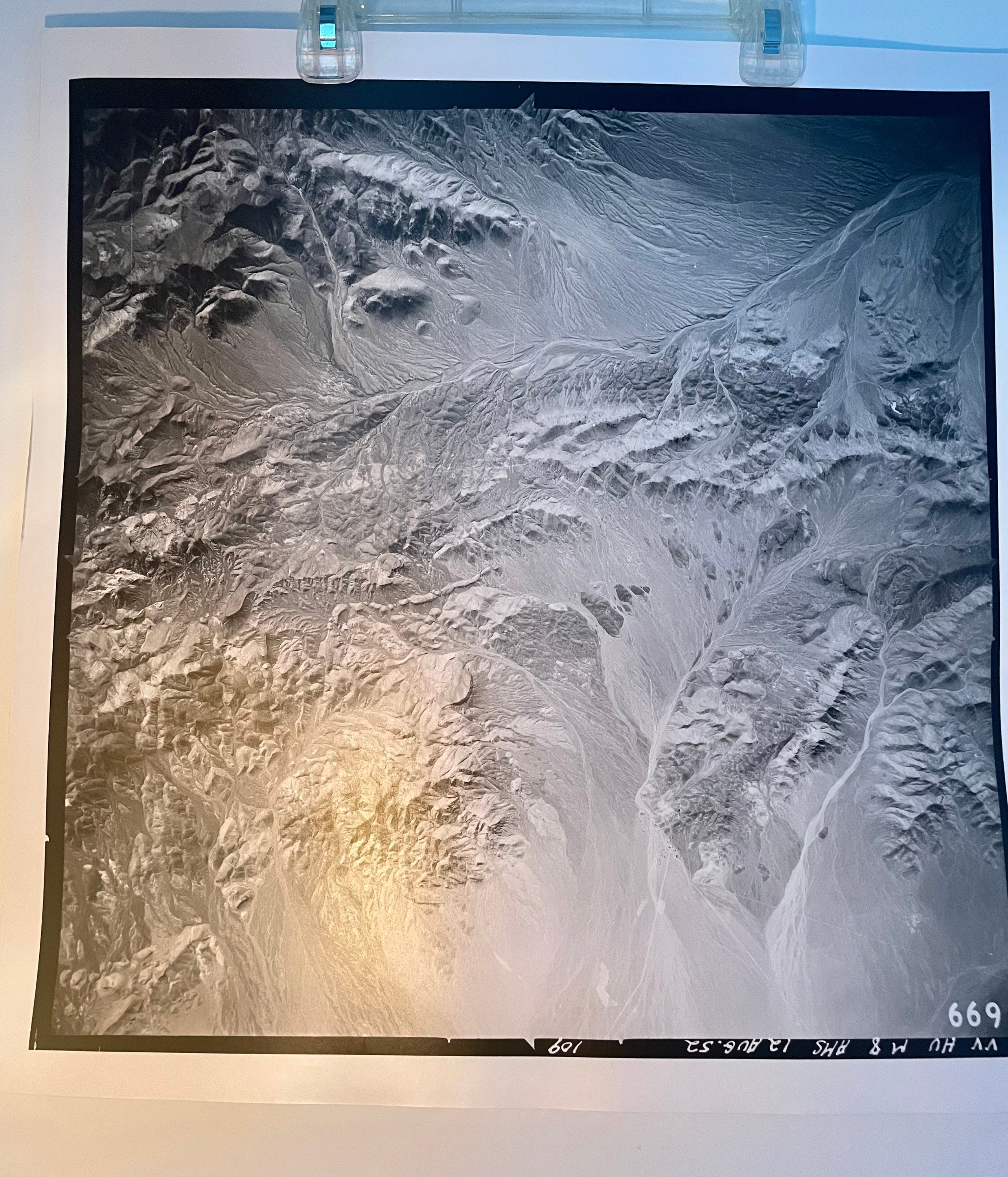
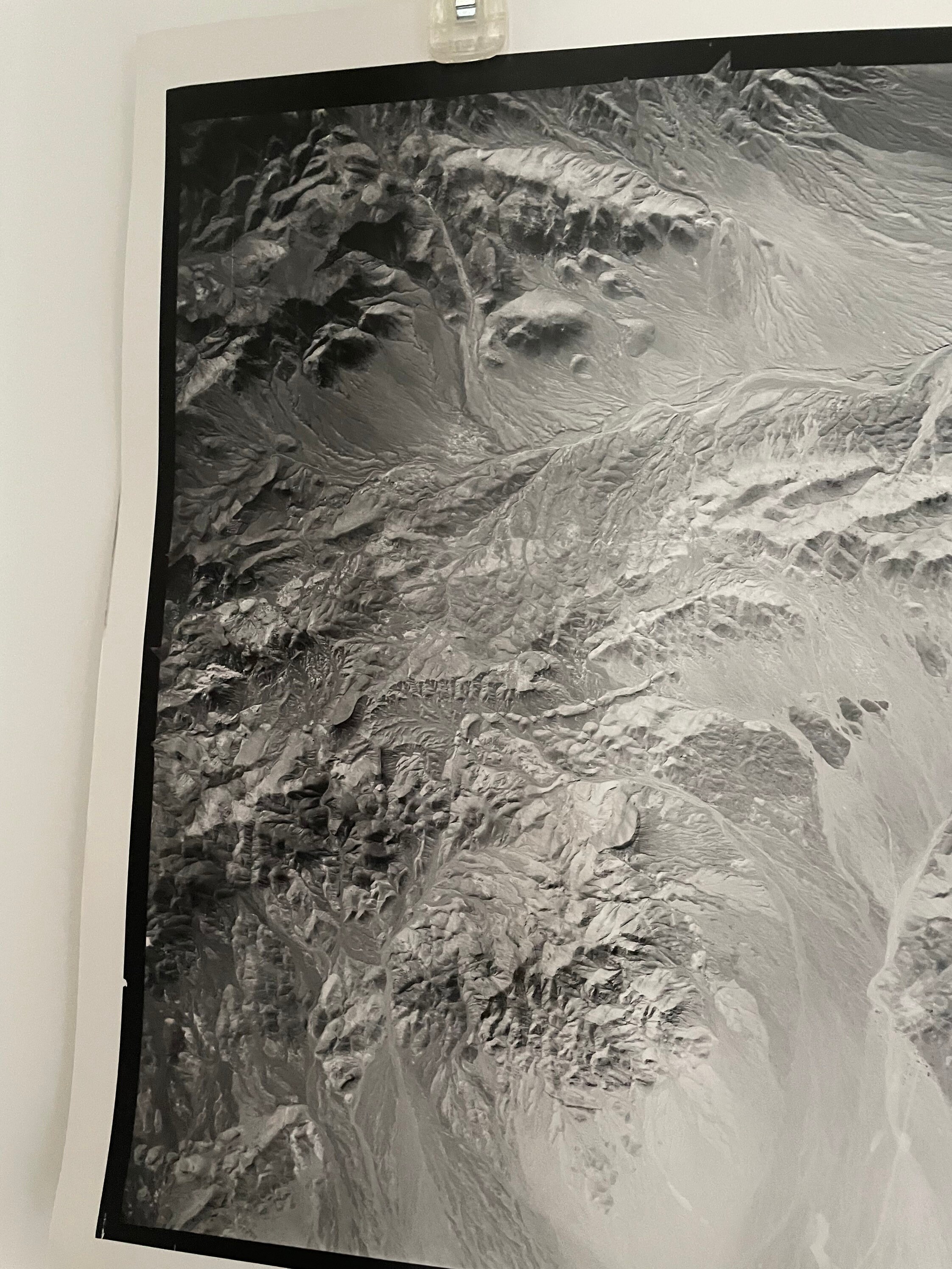
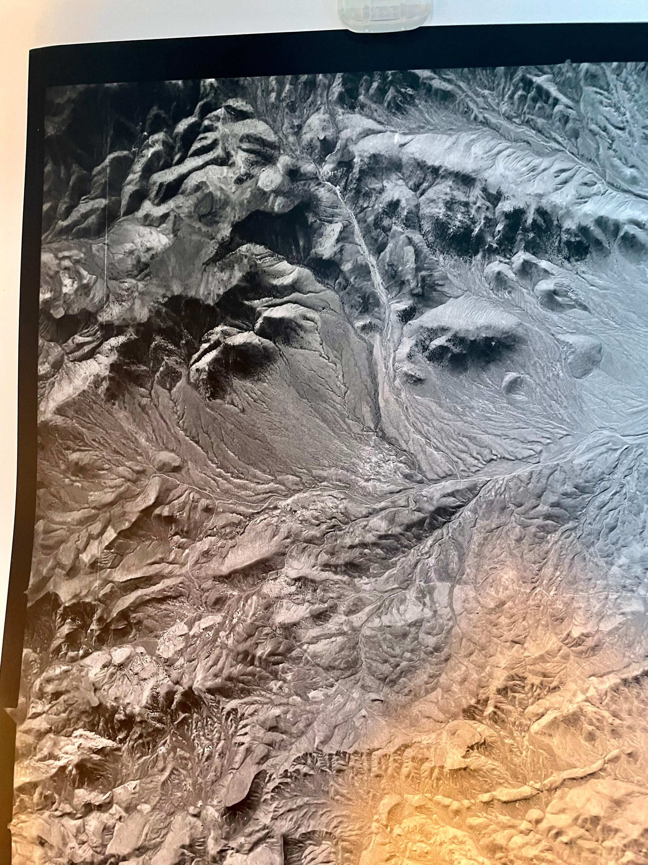
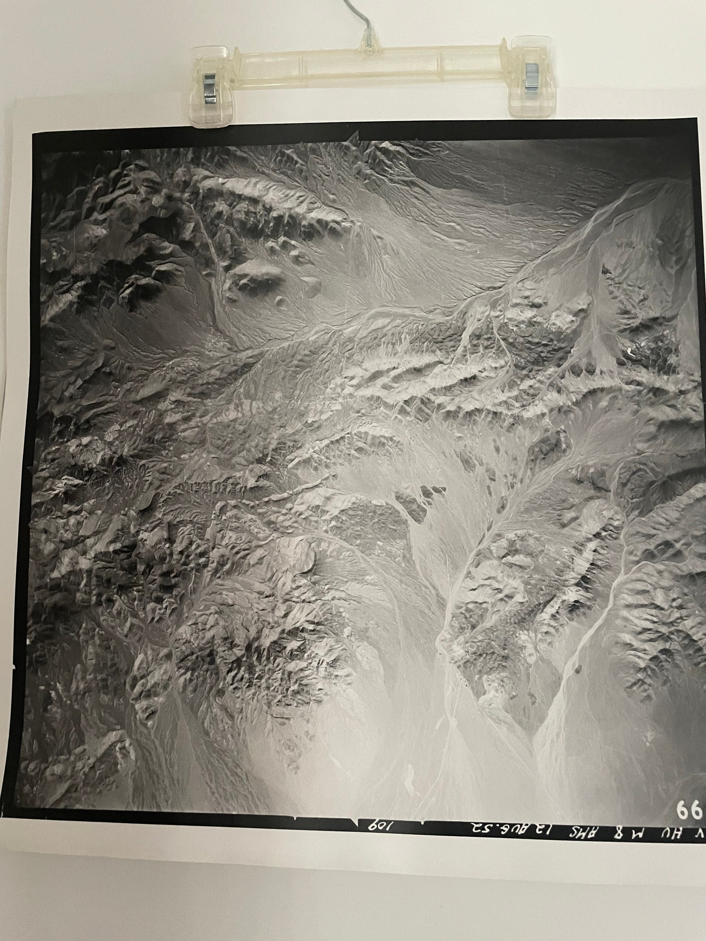
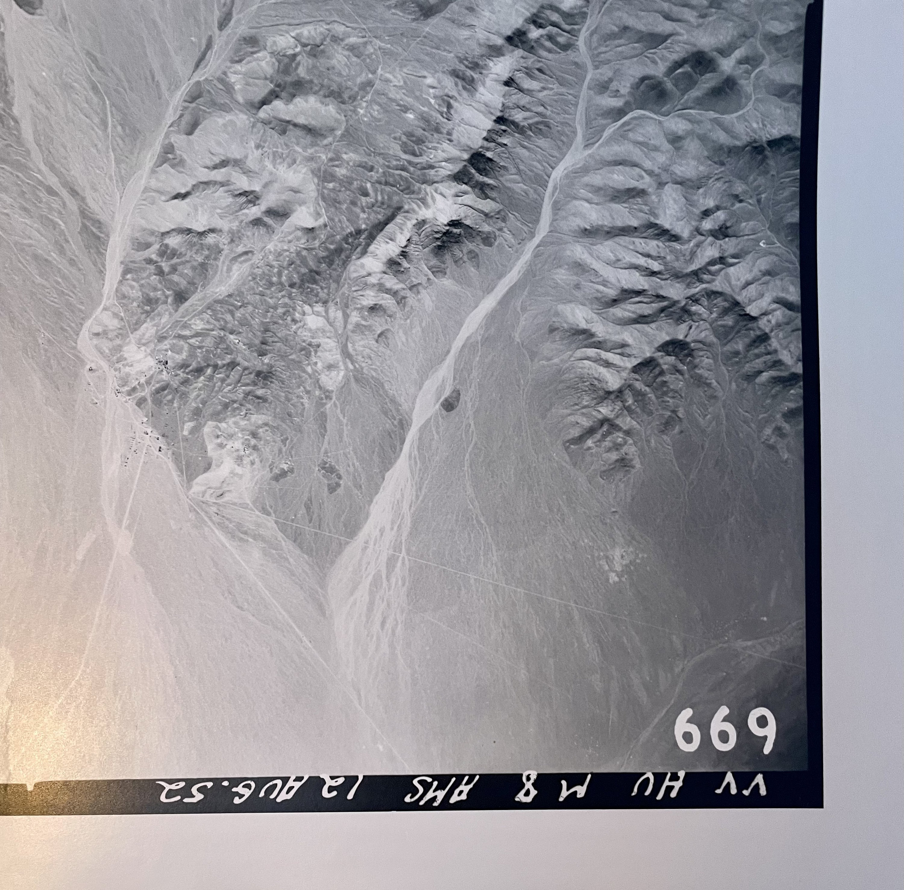
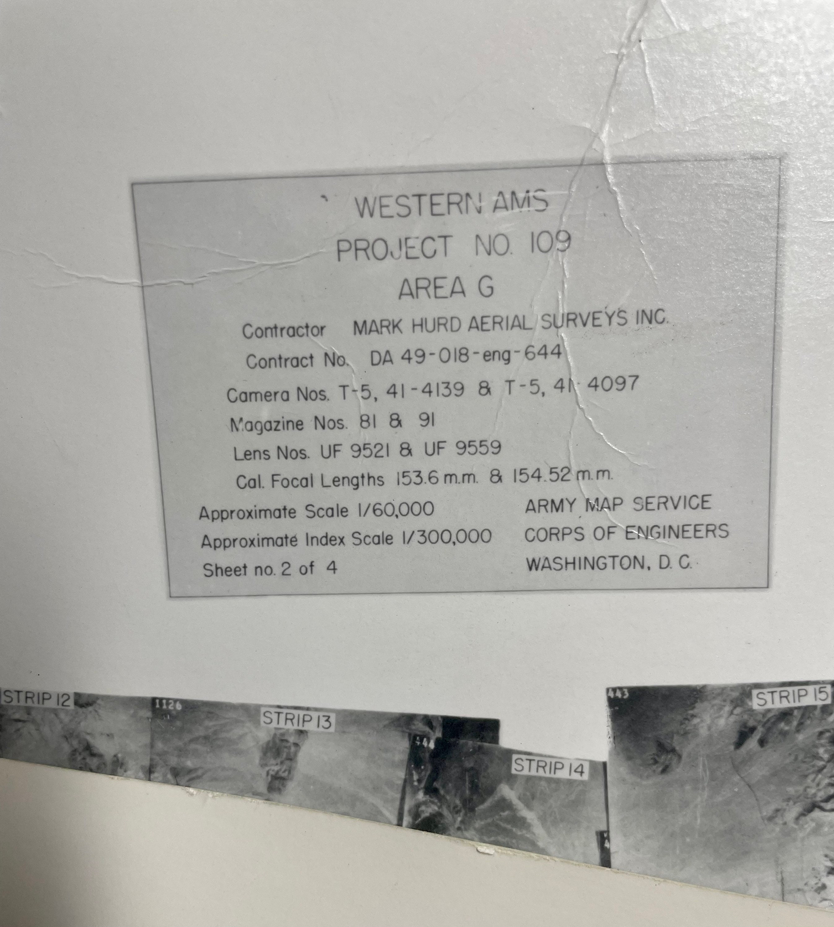
Aerial Photograph from Western Army Map Service Project No. 109 #669 - Army Map Service 1952
$75.00
This single aerial photography frame from the Western Army Map Service Project No. 109 was captured on August 12, 1952. There are several additional photographs in varying condition, including the index of photos that form the collections Area F and Area G.
This is an extremely rare opportunity to own a piece of history in the form of a beautiful and interesting vintage photograph that correlates to the Army Map Service, Corp of Engineering, topographical maps. This photograph would make a wonderful gift for the Historian, Photographer, Environmentalist, or vintage ephemera collector to display as intriguing, beautiful, and unique home decor.
Physical Format
Black and White Physical Aerial Photograph
Date Flown: Aug 12, 1952
Reference Item: UGS Aerial Imagery Collection
Dimension: 20" x 20"
Condition: Excellent vintage condition commensurate with age, sold "As Is"
Maps and photographs are rolled up and shipped in sturdy mailing tubes.
About the Photography
Most of the frames were acquired in stereoscopic mode, meaning successive frames overlap and create stereo pairs that provide a three-dimensional (3D) image when viewed with a stereoscope. A small percentage of the frames are low-sun-angle photographs acquired during the morning or afternoon when shadows highlight certain topographic features, such as fault scarps, or oblique photographs taken at a non-vertical angle to the ground, like a panorama.
Various federal government agencies originally acquired most of these frames for agricultural and/or forest management purposes. This photography is now integral to many geologic projects, such as geologic mapping and geologic-hazard investigations, along with land-use planning and management and other uses.
About the Photographer
Mark Hurd, friend of Amelia Earhart, was born in 1892 in Minnesota, and lived a storied life. He became interested in aerial photography in the 1920's, during WW1, where he served as a fighter pilot in the fledgling air arm of the U.S. Army, serving in France, as part of the famed Lafayette Escadrille. Upon his return from WWI, he purchased a Sopwith Camel airplane and began his career in commercial aviation activities.
"Photogrammetric Pioneers Mark Hurd Aerial Surveys, Inc."
MARK HURD AERIAL SURVEYS, INC., which grew to a 25-plotter, 125-person operation in the 1960's, began in a small Minneapolis shop fifty years ago. Mark M. Hurd, a World War I fighter pilot,
during the 1930's designed and produced a simple, rugged aerial camera which became widely known for its reliability and ease of maintenance. In this camera, the film was held flat by air pressure rather than by vacuum; air was scooped up by the motion of the plane and led through a tube into the camera chamber, eliminating any chance of vacuum failure, a common plague in those days.
Mark Hurd served in the Army Air Corps again in World War 11 before returning to Minneapolis, where he invited Raymond H. Miller and Allan C. Bock, a pilot-photographer team, to join him in
forming Mark Hurd Mapping Company. A rousing success "from day one," the company rapidly expanded to a six-crew operation that successfully photographed huge blocks of the United States for the Army Map Service, Michael Baker, Jr., Inc., Alster & Associates, and others. Using simple navigational devices and automatic camera mounts developed by Miller, Hurd crews
flew unpressurized P-38 Lightnings (a World War 1 reconnaissance plane), using heated flying suits and oxygen masks at altitudes to 36,000 feet.
In 1954, the company expanded into topographic mapping under the direction of Joseph P. Burns, a civil engineer and photogrammetrist, previously employed by the Geological Survey. The topographic operation successfully completed highway PHOTOCRAMMETRIC ENGINEERING AND REMOTE SENSING, Vol. 50, No. 9, September 1984, pp. 1291. maps in Ethiopia, Tanzania, Bolivia, Chile, and other Latin American countries, as sub-contractors to several large engineering firms. In 1960, Hurd surveyors pushed a 70-mile line through heavy woods in mapping and staking the SunshineSummit sector of the Anchorage-Fairbanks highway in Alaska.
In 1968, Ray Miller, pilot, mechanical engineer, and regarded by many as a mechanical genius, conceived the idea of building an aerial camera in the access door of the Lear jet, a small, fast-climbing business jet that could attain 44,000 feet in twenty minutes and proceed along flight lines at 550 miles per hour. This brilliant concept led the company into another prosperous era; for the past ten years it has photographed large parts of the United States and foreign areas at high altitude.
from PHOTOCRAMMETRIC ENGINEERING AND REMOTE SENSING, Vol. 50, No. 9, September 1984, pp. 1291.
0099-1112/84/5009-1291$02.25/0O 1984 American Society of Photogrammetry
Shipping from United States
Processing time
1-3 business days
Customs and import taxes
Buyers are responsible for any customs and import taxes that may apply. I'm not responsible for delays due to customs.
Payment Options
Returns & Exchanges
I gladly accept returns and exchanges
Just contact me within: 14 days of delivery
Ship items back to me within: 30 days of delivery
I don't accept cancellations
But please contact me if you have any problems with your order.
The following items can't be returned or exchanged
Because of the nature of these items, unless they arrive damaged or defective, I can't accept returns for:
- Custom or personalized orders
- Perishable products (like food or flowers)
- Digital downloads
- Intimate items (for health/hygiene reasons)
Conditions of return
Buyers are responsible for return shipping costs. If the item is not returned in its original condition, the buyer is responsible for any loss in value.
Frequently Asked Questions
Custom and personalized orders
Please contact me with details regarding your intention, any specific substitutions, or other details and I will be happy to accommodate a custom order for you.