Authentic 1954 Topographic Map of Muir Woods National Monument, San Rafael, and Sausalito, California
$75.00
🗺️ Own a Piece of History with This Authentic 1954 Topographic Map! 🗺️
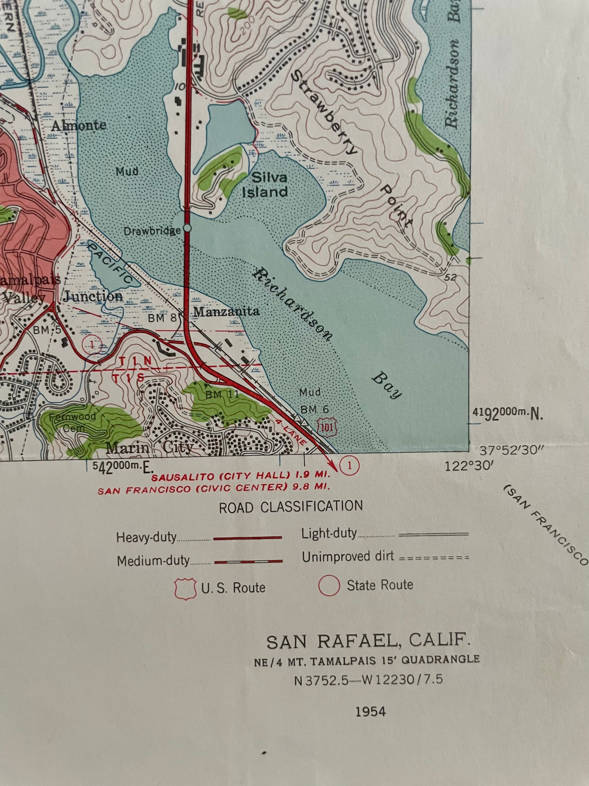
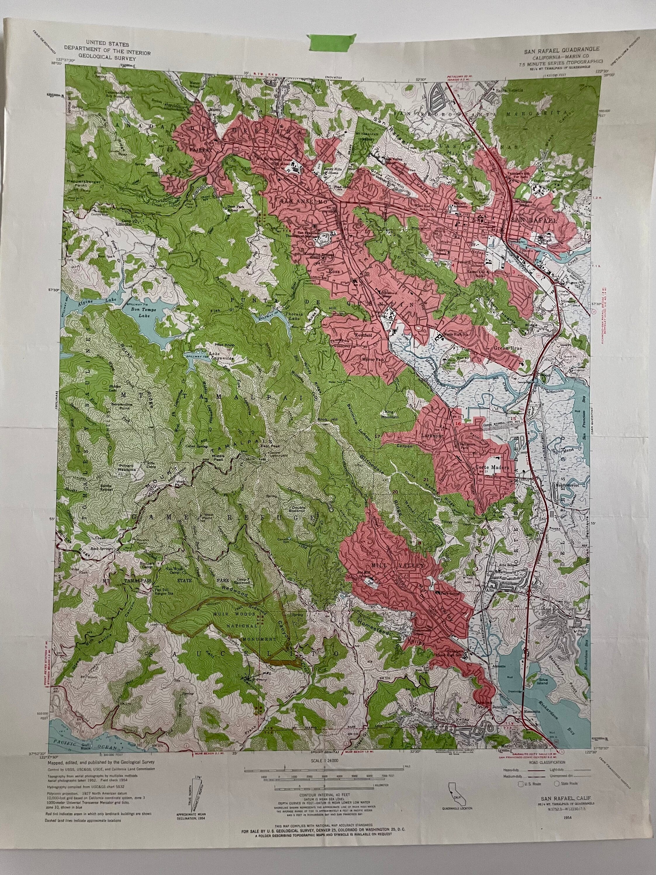
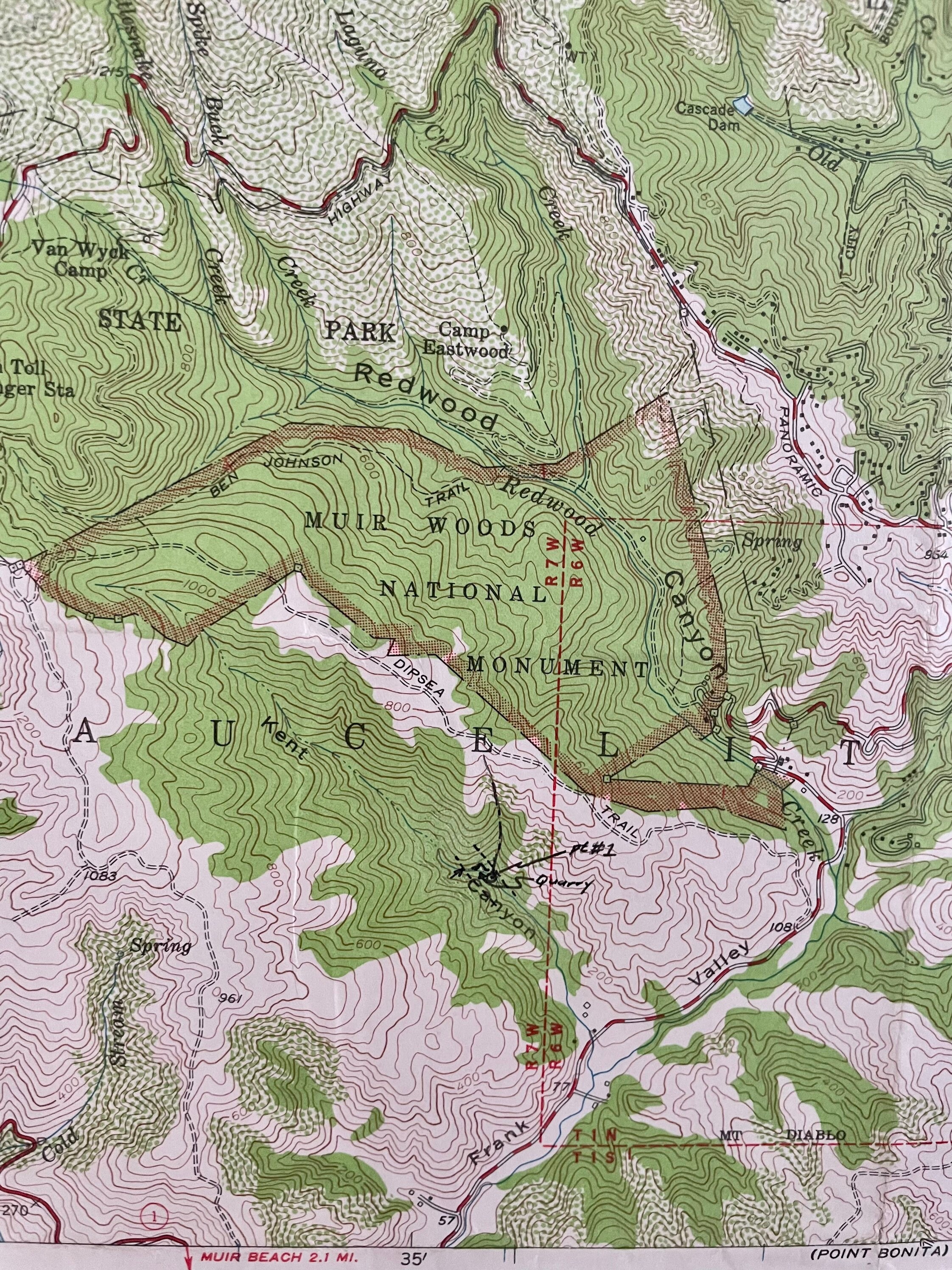
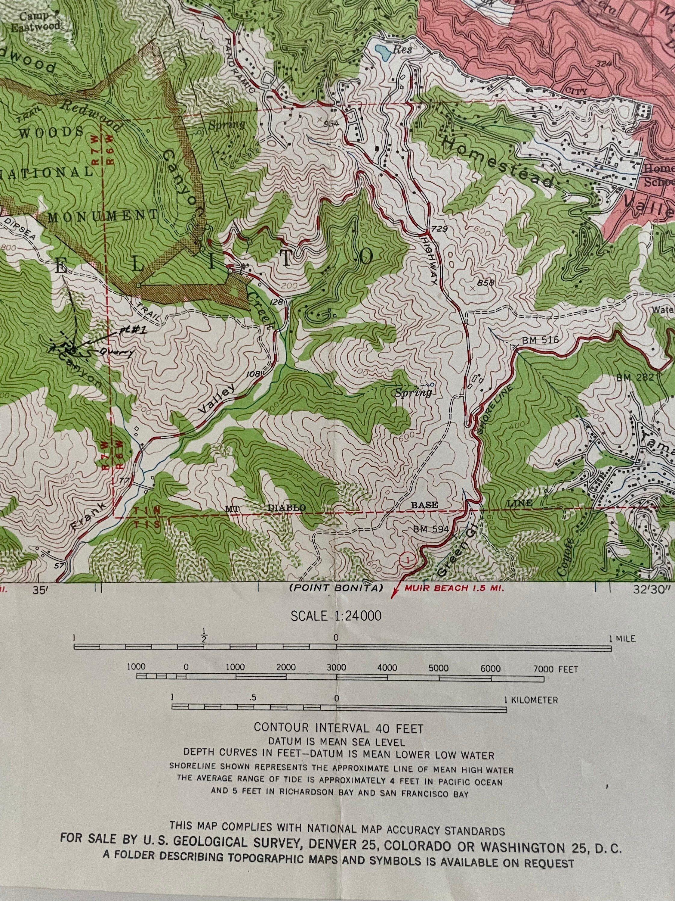
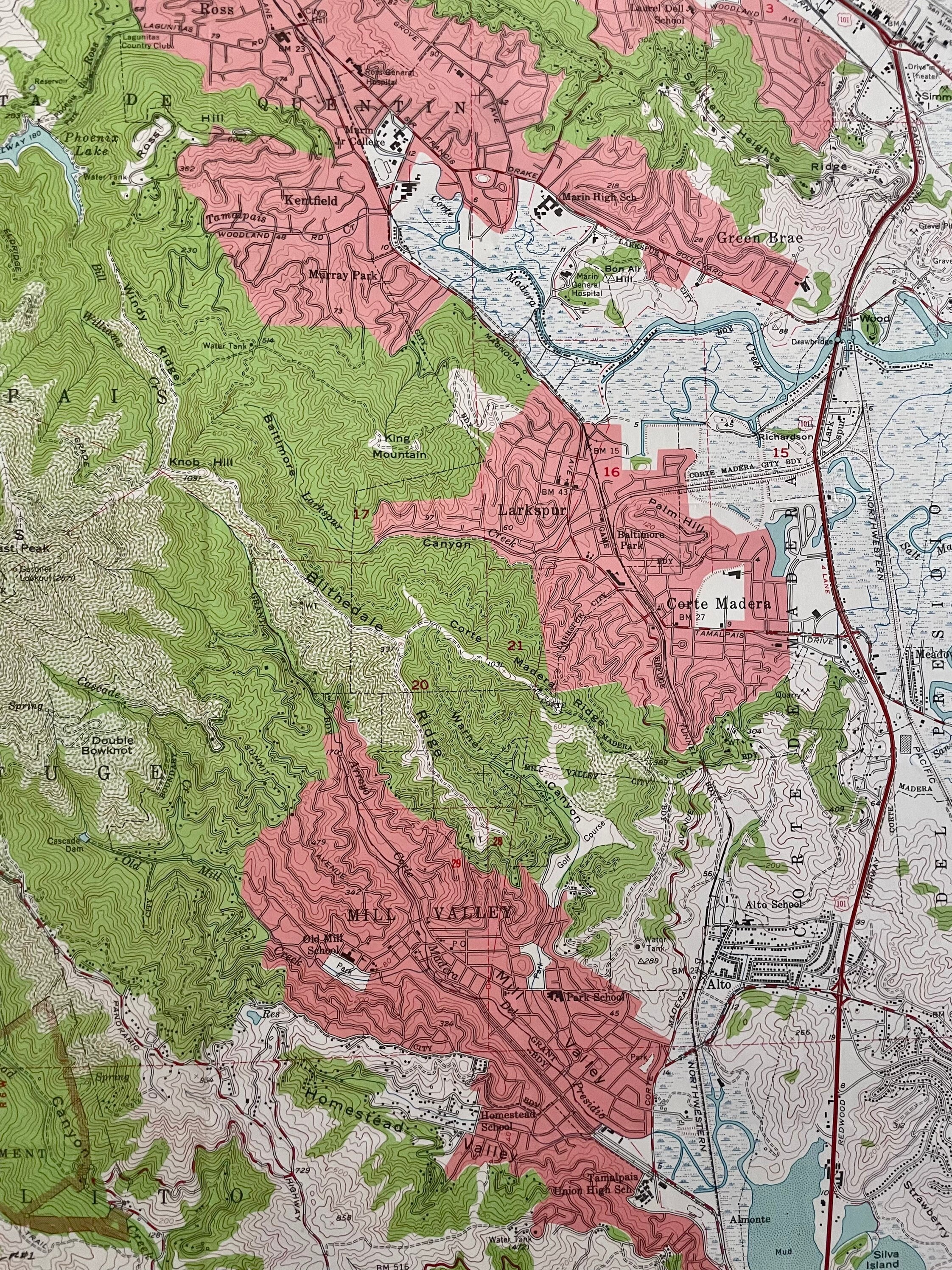
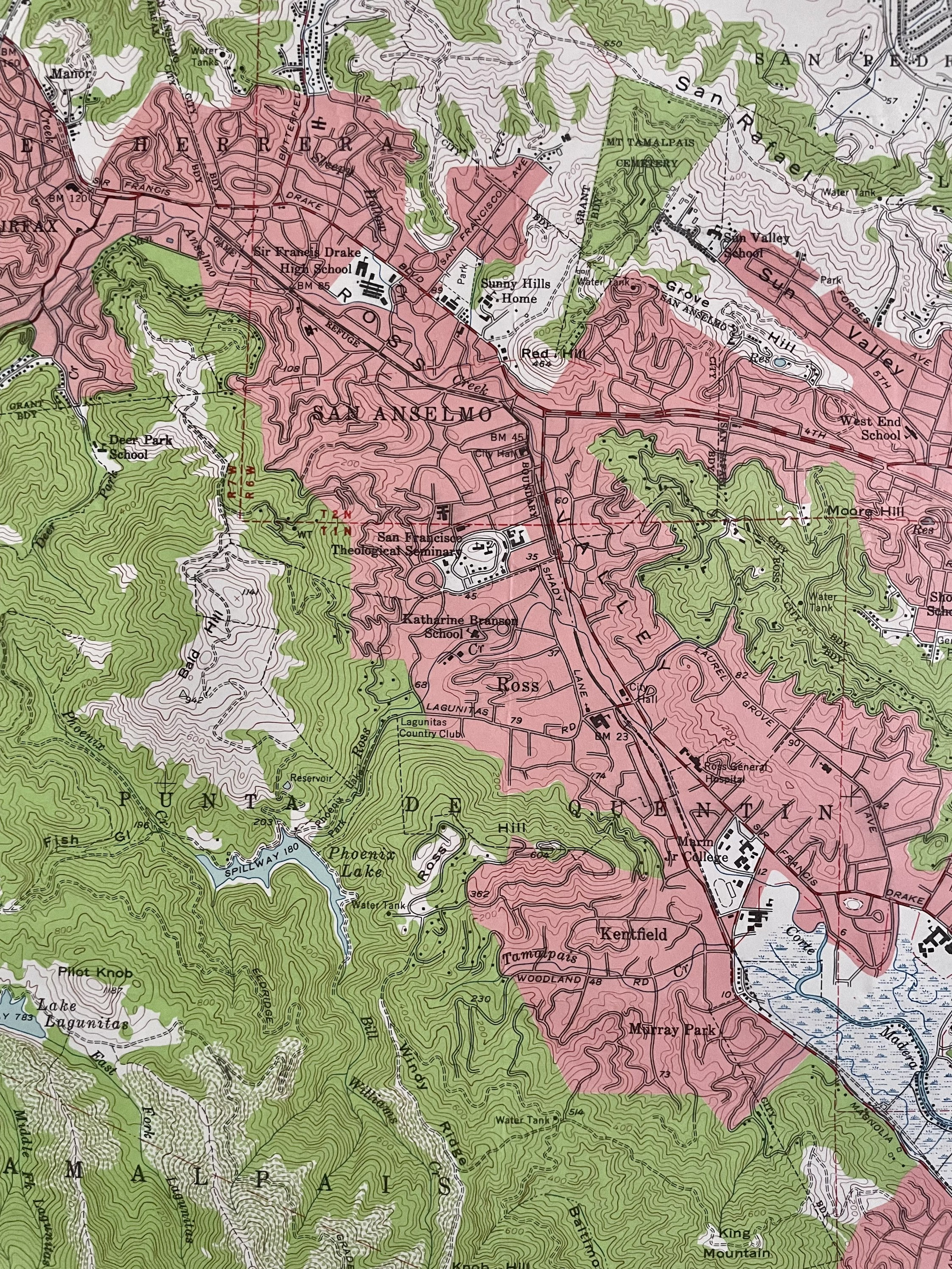
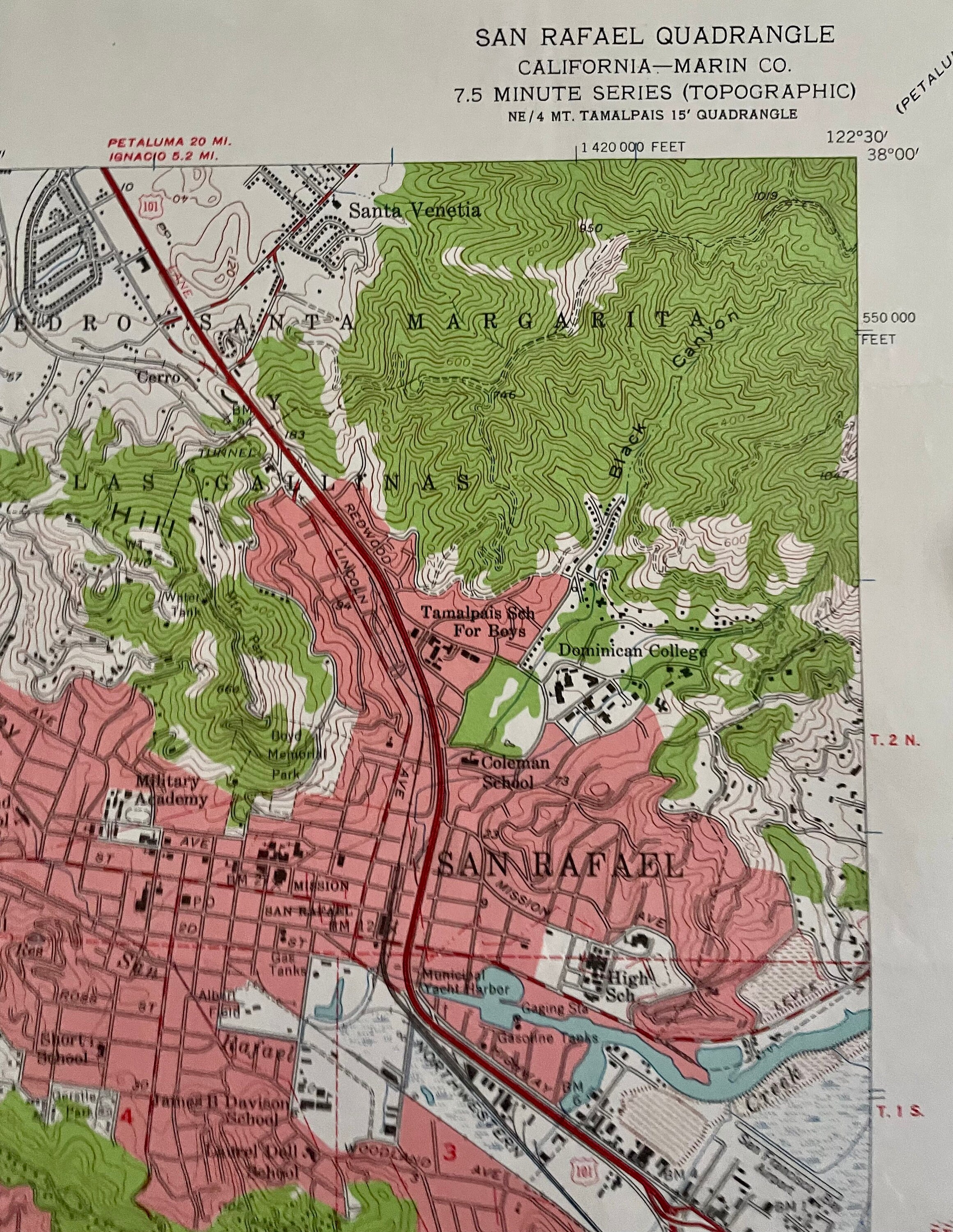
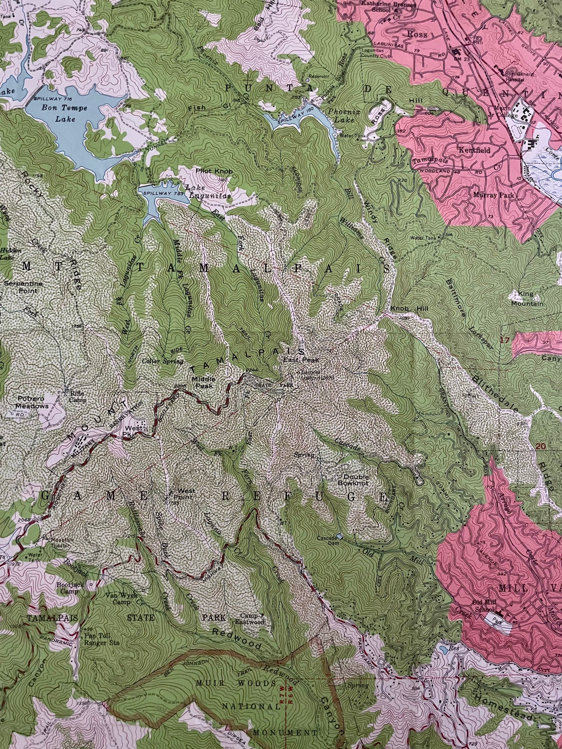
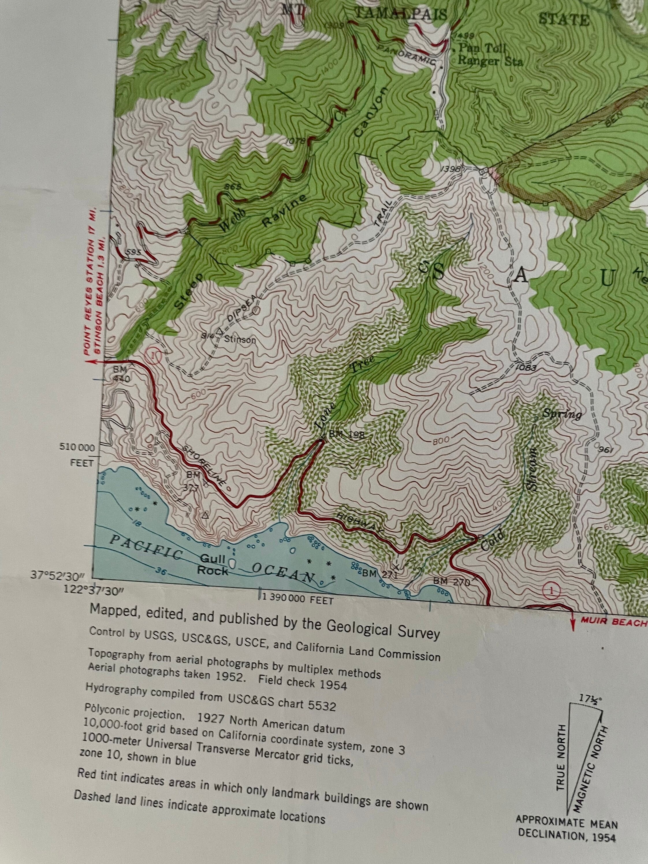
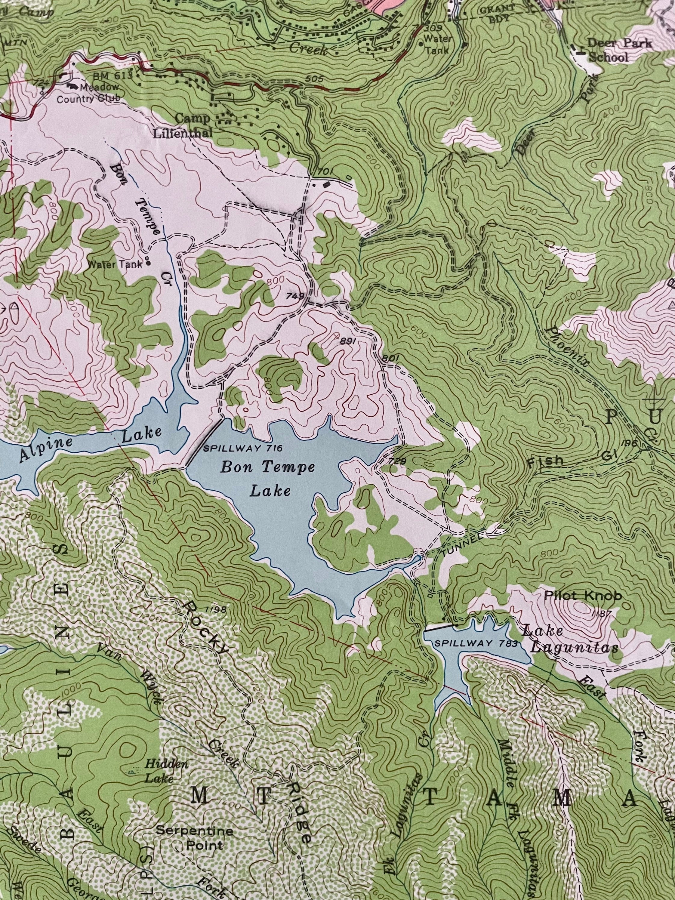
This historical topographic map of the Muir Woods National Monument, San Rafael, and Sausalito, California, printed in 1954, is a coveted collectible that makes fantastic wall decor for your home. This full-color, 7.5-minute series map offers an interesting view of California from times gone by, featuring detailed depictions of the Redwood canyon of Mt. Tamalpais State Park, Tomales Bay, Canada de Herrara, San Pedro, Santa Margarita, and much more.
Product Details:
Map Title: Muir Woods National Monument, San Rafael, and Sausalito, California
Printed: 1954 (by U.S. Geological Survey)
Size: 27" x 22"
Scale: 1:24000
Series: 7.5-Minute Series
Contour Interval: 40 feet
Condition: Excellent condition, commensurate with age
Authenticity: This is an authentic 1954 print from the U.S. Geological Survey, NOT a computer reproduction
Topography: Derived from aerial photographs using multiplex methods (aerial photographs taken in 1952)
Features: Red tint indicates areas in which only landmark buildings are shown
This map is a compelling visual artifact of the 1950s and a unique historical reference or piece of art from the West Coast that never goes out of style. Whether you are a collector, outdoorsman, historian, or designer, this rare find is a must-have!
Perfect For:
Historians: A valuable and rare historical reference.
Collectors: This authentic map from the 1950s is ideal for any collection.
Outdoor Enthusiasts: A fascinating depiction of Muir Woods National Monument and its surroundings.
Home Décor: A unique and vintage wall art piece sure to be a conversation starter.
Gift-Giving: A special and thoughtful gift for map lovers and history buffs.
Shipping Information:
We will happily adjust the shipping price for multiple purchases. Maps are rolled up and shipped in sturdy mailing tubes to ensure safe delivery.
Why You'll Love This Map:
Authenticity: A genuine 1954 topographic map, not a reproduction.
Historical Significance: A true artifact from the 1950s, illustrating Muir Woods and surrounding areas.
Detailed Depiction: Features valleys, mountains, camps, jails, springs, and much more.
Versatile Use: Perfect for display, collection, or as an educational resource.
Ready to Own This Historical Treasure?
Feel free to message me with any questions or special requests. This is a rare opportunity that you don’t want to miss out on!
Shipping from United States
Processing time
1-3 business days
Customs and import taxes
Buyers are responsible for any customs and import taxes that may apply. I'm not responsible for delays due to customs.
Payment Options
Returns & Exchanges
I gladly accept returns and exchanges
Just contact me within: 14 days of delivery
Ship items back to me within: 30 days of delivery
I don't accept cancellations
But please contact me if you have any problems with your order.
The following items can't be returned or exchanged
Because of the nature of these items, unless they arrive damaged or defective, I can't accept returns for:
- Custom or personalized orders
- Perishable products (like food or flowers)
- Digital downloads
- Intimate items (for health/hygiene reasons)
Conditions of return
Buyers are responsible for return shipping costs. If the item is not returned in its original condition, the buyer is responsible for any loss in value.
Frequently Asked Questions
Custom and personalized orders
Please contact me with details regarding your intention, any specific substitutions, or other details and I will be happy to accommodate a custom order for you.